BBC News
 Getty Images
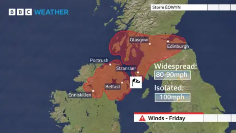
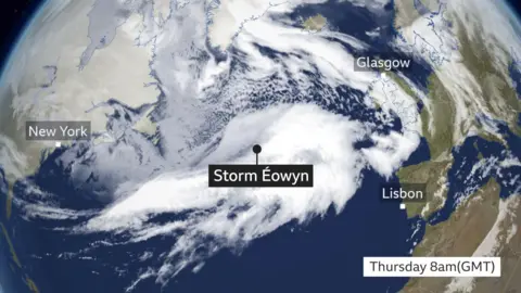
Red warnings have been issued for Northern Ireland and parts of Scotland on Friday, as dangerous Storm Éowyn heads towards the UK.
The rare warnings for wind gusts mean flying debris could cause a danger to life, with gusts up to 100mph (161km/h) along some exposed coasts.
The Met Office warned people to expect damage to buildings with roofs blown off and significant disruption to travel.
An amber warning is also in place for parts of Scotland and the north of England on Friday. The entire rest of the country is under at least one yellow warning as Éowyn brings strong winds, rain and snow.
The red warning for the whole of Northern Ireland will be in force from 07:00 to 14:00 on Friday, affecting the morning rush hour.
Then as the storm moves east, a red warning is in place across Scotland’s central belt, including Glasgow and Edinburgh, from 10:00 to 17:00.
Winds there will rapidly increase mid-morning into the afternoon with peak gusts of 80-90mph (129-145km/h) widely.
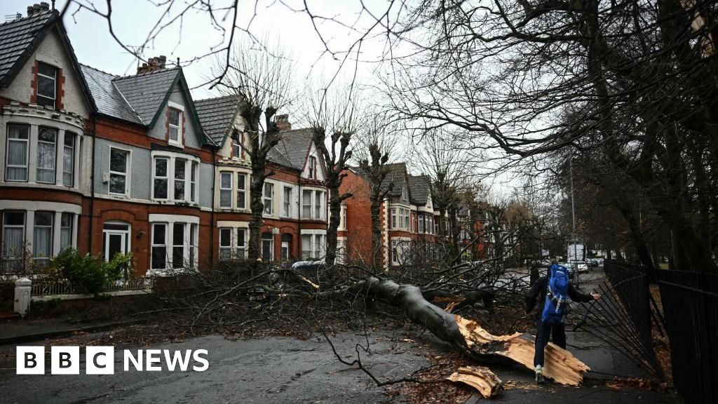
There will likely to a be a large number of trees blown over with widespread disruption to travel with roads badly affected, flights, trains and ferries will be subject to cancellations.
Power cuts are also likely, some of which could last for a number of days.
The Met Office warns it is very likely there will be a risk to life and people should avoid travelling where possible.

For the Republic of Ireland, this could be the storm of the century, BBC Weather said.
Irish forecasters Met Éireann have already issued blanket red weather warnings covering all of the Republic of Ireland for widespread gusts in excess of 80mph.
Structural damage along with widespread disruption to transport and power is guaranteed.
Meanwhile, the amber warning for wind is in place on Friday from 06:00 GMT to 21:00, for the north of England, north Wales and Scotland’s central belt.
Train operators Avanti, LNER, Lumo and Northern have issued warnings not to travel in the north of England and north Wales on Friday.

However, the big change to the UK’s weather begins on Thursday, as heavy rain and strong and gusty winds move across the country.
Parts of the south coast of England, South West and much of the Welsh coast are covered by a yellow weather warning for wind until 18:00 GMT on Thursday.
It is likely sea fronts will be affected by spray and large waves and power and travel disruption.
Early on Friday Storm Éowyn will begin to affect the UK with winds initially in the south-western part of the UK with heavy rainfall before quickly spreading north-east to the rest of the UK.
There is also a chance of snow over parts of Northern Ireland, Scotland and the north.
The yellow warnings in place on Friday are for:
- wind in parts of the Midlands, east of England, London and South East England from 05:00 to 15:00
- rain in parts of Wales, the South West and West Midlands from midnight to to 09:00
- wind across most of the country from midnight until 23:59
- snow in Scotland, in parts of the North East, North West from 03:00 until 12:00
Storm Eowyn is fifth named storm of the season.


Leave a Reply